Map Categories
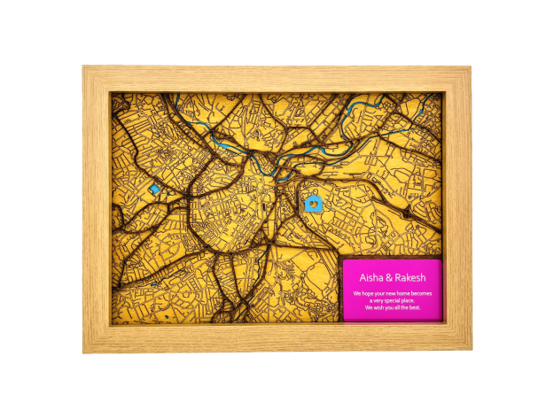
All maps consist of multiple layers stacked one on top of each other. The bottom layer represents waterways which have been precisely cut to form rivers, lakes, and oceans.
Above that, is the land layer, featuring local roads these are typically categorised as “Unclassified” roads, these roads are intricately engraved into the wood, creating a detailed street network.
The final top layer depicts the “Classified” roads these are typically the A and B roads and Motorways.
The overall effect is a 3D representation of the local geography, with roads and waterways standing out against the landscape.
Contact us to explore our wide range of 3D Wooden Laser Cut maps to find that map you're looking for:
We need your consent to load the translations
We use a third-party service to translate the website content that may collect data about your activity. Please review the details in the privacy policy and accept the service to view the translations.


